Geodesic Tools. More...
Detailed Description
Geodesic Tools.
Let's talk about Geodesic tools and thinning...
 Collaboration diagram for Geodesic Tools:
Functions | |
| template<typename T1 , typename T2 > | |
| RES_T | labelFlatZonesWithProperty (const Image< T1 > &imIn, Image< T2 > &imOut, string property="geodesicDiameter") |
| labelFlatZonesWithProperty() : Evaluate a prpperty for each flat zone in a gray scale image More... | |
| template<typename T1 , typename T2 > | |
| RES_T | geodesicDiameter (const Image< T1 > &imIn, Image< T2 > &imOut, bool sliceBySlice=false, double dzOverDx=1.) |
| geodesicDiameter() - Barycenter Geodesic Diameter More... | |
| template<typename T1 , typename T2 > | |
| RES_T | geodesicElongation (const Image< T1 > &imIn, Image< T2 > &imOut, bool sliceBySlice=false, double dzOverDx=1.) |
| geodesicElongation() - Geodesic Elongation More... | |
| template<typename T1 , typename T2 > | |
| RES_T | geodesicTortuosity (const Image< T1 > &imIn, Image< T2 > &imOut, bool sliceBySlice=false) |
| geodesicTortuosity() - Geodesic Tortuoisity More... | |
| template<typename T1 , typename T2 > | |
| RES_T | geodesicExtremities (const Image< T1 > &imIn, Image< T2 > &imOut, bool sliceBySlice=false, double dzOverDx=1.) |
| geodesicExtremities() - Geodesic Extremities More... | |
| template<typename T1 , typename T2 > | |
| RES_T | geodesicProperty (const Image< T1 > &imIn, Image< T2 > &imOut, string property="geodesicDiameter", bool sliceBySlice=false, double dzOverDx=1.) |
| geodesicProperty() - More... | |
| template<typename T1 , typename T2 > | |
| RES_T | geodesicPathOpening (const Image< T1 > &imIn, Image< T2 > &imOut, double lenght, string property="geodesicDiameter", double scaleX=1., double scaleY=1., double scaleZ=1.) |
| geodesicPathOpening() - More... | |
| template<typename T1 , typename T2 > | |
| RES_T | geodesicPathClosing (const Image< T1 > &imIn, Image< T2 > &imOut, double lenght, string property="geodesicDiameter", double scaleX=1., double scaleY=1., double scaleZ=1.) |
| geodesicPathClosing() - More... | |
| template<typename T1 , typename T2 > | |
| RES_T | geodesicUltimatePathOpening (const Image< T1 > &imIn, Image< T1 > &imTrans, Image< T2 > &imInd, double scaleX, double scaleY, double scaleZ, size_t stop, int lambdaAttribute, int takeMin) |
| geodesicUltimatePathOpening() - More... | |
| template<typename T1 , typename T2 > | |
| RES_T | geodesicUltimatePathClosing (const Image< T1 > &imIn, Image< T1 > &imTrans, Image< T2 > &imInd, double scaleX, double scaleY, double scaleZ, size_t stop, int lambdaAttribute, int takeMin) |
| geodesicUltimatePathClosing() - More... | |
Function Documentation
◆ labelFlatZonesWithProperty()
| RES_T smil::labelFlatZonesWithProperty | ( | const Image< T1 > & | imIn, |
| Image< T2 > & | imOut, | ||
| string | property = "geodesicDiameter" |
||
| ) |
labelFlatZonesWithProperty() : Evaluate a prpperty for each flat zone in a gray scale image
- Parameters
-
[in] imIn : input image [out] imOut : output image [in] property : one of - "geodesicDiameter"
- "elongation"
- "tortuosity"
- "extremities"
◆ geodesicDiameter()
| RES_T smil::geodesicDiameter | ( | const Image< T1 > & | imIn, |
| Image< T2 > & | imOut, | ||
| bool | sliceBySlice = false, |
||
| double | dzOverDx = 1. |
||
| ) |
geodesicDiameter() - Barycenter Geodesic Diameter
This function evaluates, for each flat zone, its Barycenter Geodesic Diameter. This value is defined as the biggest Geodesic Distance between any two points in the flat zone.
- The flat zone is labeled with the result.
- See also
- For a detailled description of this attribute, see [12]
- Parameters
-
[in] imIn : binary input image [out] imOut : output image [in] sliceBySlice : apply the algorithm to the whole image or slice by slice [in] dzOverDx :
◆ geodesicElongation()
| RES_T smil::geodesicElongation | ( | const Image< T1 > & | imIn, |
| Image< T2 > & | imOut, | ||
| bool | sliceBySlice = false, |
||
| double | dzOverDx = 1. |
||
| ) |
geodesicElongation() - Geodesic Elongation
This function evaluates, for each flat zone, its Geodesic Elongation defined by the relation :
![\[ E(X) = \dfrac{\pi \:.\: L^{2}(X)}{4 \:.\: S(X)} \]](form_3.png)
where  is the Geodesic Diameter of the flat zone and
  is the Area of the flat zone.
The flat zone is labeled with the result.
- See also
- For a detailled description of this attribute, see [12]
- Parameters
-
[in] imIn : binary input image [out] imOut : output image [in] sliceBySlice : apply the algorithm to the whole image or slice by slice [in] dzOverDx :
◆ geodesicTortuosity()
| RES_T smil::geodesicTortuosity | ( | const Image< T1 > & | imIn, |
| Image< T2 > & | imOut, | ||
| bool | sliceBySlice = false |
||
| ) |
geodesicTortuosity() - Geodesic Tortuoisity
This function evaluates, for each flat zone, its Geodesic Tortuoisity defined by the relation :
![\[ T(X) = \dfrac{L(X)}{L_{Euclidean}(X)} \]](form_6.png)
where is the Geodesic Diameter of the flat zone and 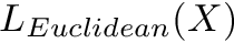 is the Euclidean Distance between the Geodesic Extremities of the flat zone.
The flat zone is labeled with the result.
- See also
- For a detailled description of this attribute, see [12]
- Parameters
-
[in] imIn : binary input image [out] imOut : output image [in] sliceBySlice : apply the algorithm to the whole image or slice by slice
◆ geodesicExtremities()
| RES_T smil::geodesicExtremities | ( | const Image< T1 > & | imIn, |
| Image< T2 > & | imOut, | ||
| bool | sliceBySlice = false, |
||
| double | dzOverDx = 1. |
||
| ) |
geodesicExtremities() - Geodesic Extremities
This function finds the Geodesic Extremities of each flat zone and set the pixel value of each extremity to an integer beginning with 1.
- Parameters
-
[in] imIn : binary input image [out] imOut : output image [in] sliceBySlice : apply the algorithm to the whole image or slice by slice [in] dzOverDx :
◆ geodesicProperty()
| RES_T smil::geodesicProperty | ( | const Image< T1 > & | imIn, |
| Image< T2 > & | imOut, | ||
| string | property = "geodesicDiameter", |
||
| bool | sliceBySlice = false, |
||
| double | dzOverDx = 1. |
||
| ) |
- Parameters
-
[in] imIn : binary input image [out] imOut : output image [in] property : one of - "geodesicDiameter"
- "elongation"
- "tortuosity"
- "extremities"
[in] sliceBySlice : apply the algorithm to the whole image or slice by slice [in] dzOverDx :
This is an overloaded member function, provided for convenience. It differs from the above function only in what argument(s) it accepts.
◆ geodesicPathOpening()
| RES_T smil::geodesicPathOpening | ( | const Image< T1 > & | imIn, |
| Image< T2 > & | imOut, | ||
| double | lenght, | ||
| string | property = "geodesicDiameter", |
||
| double | scaleX = 1., |
||
| double | scaleY = 1., |
||
| double | scaleZ = 1. |
||
| ) |
- Parameters
-
[in] imIn : input image [in] lenght : [in] property : one of - "geodesicDiameter"
- "elongation"
- "tortuosity"
- "extremities"
[out] imOut : output image [in] scaleX,scaleY,scaleZ :
◆ geodesicPathClosing()
| RES_T smil::geodesicPathClosing | ( | const Image< T1 > & | imIn, |
| Image< T2 > & | imOut, | ||
| double | lenght, | ||
| string | property = "geodesicDiameter", |
||
| double | scaleX = 1., |
||
| double | scaleY = 1., |
||
| double | scaleZ = 1. |
||
| ) |
- Parameters
-
[in] imIn : input image [in] lenght : [in] property : one of - "geodesicDiameter"
- "elongation"
- "tortuosity"
- "extremities"
[out] imOut : output image [in] scaleX,scaleY,scaleZ :
◆ geodesicUltimatePathOpening()
| RES_T smil::geodesicUltimatePathOpening | ( | const Image< T1 > & | imIn, |
| Image< T1 > & | imTrans, | ||
| Image< T2 > & | imInd, | ||
| double | scaleX, | ||
| double | scaleY, | ||
| double | scaleZ, | ||
| size_t | stop, | ||
| int | lambdaAttribute, | ||
| int | takeMin | ||
| ) |
geodesicUltimatePathOpening() -
- Parameters
-
[in] imIn : input image [out] imTrans : input image [out] imInd : input image [in] scaleX,scaleY,scaleZ : [in] stop : [in] lambdaAttribute : [in] takeMin :
◆ geodesicUltimatePathClosing()
| RES_T smil::geodesicUltimatePathClosing | ( | const Image< T1 > & | imIn, |
| Image< T1 > & | imTrans, | ||
| Image< T2 > & | imInd, | ||
| double | scaleX, | ||
| double | scaleY, | ||
| double | scaleZ, | ||
| size_t | stop, | ||
| int | lambdaAttribute, | ||
| int | takeMin | ||
| ) |
geodesicUltimatePathClosing() -
- Parameters
-
[in] imIn : input image [out] imTrans : input image [out] imInd : input image [in] scaleX,scaleY,scaleZ : [in] stop : [in] lambdaAttribute : [in] takeMin :